This content examines the strategic necessity and engineering challenges of British military air base construction in the Bahamas during World War II, including the establishment of primary air bases and satellite fields. It also touches upon the long-term socio-economic impacts of this infrastructure development.
During the Second World War, the geography of the Atlantic Ocean became a critical theater for the survival of the Allied cause. For the British Empire, the Bahamas represented more than just a tropical archipelago; they were a vital strategic waypoint for controlling sea lanes and protecting the approaches to the Americas. The rapid mobilization of military construction during this era transformed the Bahamian landscape, shifting it from a colonial outpost to a fortified hub of aerial and maritime defense.
The Strategic Necessity of Bahamian Air Bases
As the conflict escalated in the early 1940s, the threat of German U-boats in the Atlantic necessitated a robust network of reconnaissance and patrol bases. The Bahamas, situated along the edge of the Gulf Stream, offered an ideal location for monitoring Atlantic shipping routes. To secure these waters, the British military prioritized the construction of air bases that could support long-range patrol aircraft.
The construction of these bases was not merely a matter of laying runways; it involved a massive logistical undertaking. Engineers had to account for the unique limestone geology of the islands, the seasonal weather patterns, and the need to integrate these facilities into a wider defense network that connected the Caribbean with North America.
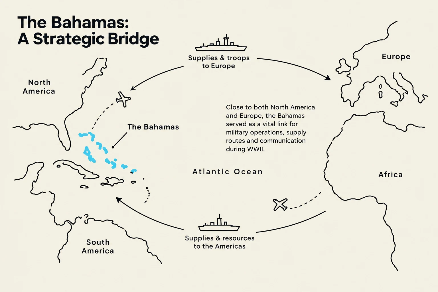
Study Tip: When analyzing WWII military geography, always consider "Line of Communication" (LoC). The Bahamas served as a vital link in the LoC between the United Kingdom and the burgeoning industrial power of the United States.
Map illustrating the strategic importance of The Bahamas as a bridge for military operations, supply routes, and communication between North America, Europe, and Africa during World War II.
The Engineering of Air Base Infrastructure
The construction of British military air bases in the Bahamas required specialized engineering solutions. Unlike the mainland, where heavy machinery and vast quantities of asphalt were readily available, the Bahamian islands presented challenges in material procurement and soil stability.
Engineers often utilized local materials, such as crushed limestone, to create stable foundations for runways. This was essential to support the weight of heavy patrol bombers. The construction process typically followed a specific hierarchy of needs:
Site Clearing: Removing native vegetation and leveling the terrain.
Drainage Systems: Implementing drainage to prevent tropical storm runoff from eroding runways.
Runway Compaction: Using heavy rollers to create a surface capable of withstanding high-frequency landings.
Support Infrastructure: Building hangars, fuel depots, and barracks for personnel.
The complexity of these projects can be viewed through the lens of resource allocation. If R represents the total available military resources and C represents the cost of construction, the efficiency of the build can be modeled by the ratio of operational capacity gained per unit of resource spent.
A key component of the Bahamian defense strategy was the establishment of the "Satellite Field." While primary air bases served as the main hubs for command, maintenance, and heavy logistics, satellite fields were smaller, auxiliary landing strips designed to extend the operational reach of the primary bases.
The Satellite Field served several critical functions:
Dispersal: By spreading aircraft across multiple locations, the military reduced the risk of a single enemy strike destroying an entire squadron.
Refueling and Re-arming: They acted as "stepping stones," allowing aircraft to extend their patrol range further into the Atlantic.
Emergency Landing Sites: They provided a safety net for aircraft experiencing mechanical failure or fuel shortages during long-range missions.
This diagram illustrates the operational relationship between a primary air base and a satellite field, detailing command, logistics, and support functions.
The relationship between the main base and the satellite field can be understood as a network of nodes. If the primary base is the central hub, the satellite field acts as a peripheral node that increases the total "coverage area" of the military's radar and patrol capabilities.
Historical Context and Long-term Impact
While the primary focus of WWII construction was immediate defense, these military developments had profound long-term effects on the region. The infrastructure built for the war—roads, cleared land, and improved communications—altered the physical and economic landscape of the Bahamas.
It is important to note that while these military developments were focused on global conflict, they occurred within the complex social and political framework of the British colonial system. The movement of troops, the influx of foreign capital, and the sudden industrialization of the islands contributed to the shifting social dynamics that would eventually play a role in the path toward Bahamian independence.
Exam Note: Be prepared to discuss how "temporary" military infrastructure can lead to "permanent" socio-economic changes in a colonial territory.
Summary Table: Primary vs. Satellite Fields
To help distinguish between the two types of military installations used in the Bahamas, refer to the following comparison:
Feature
Primary Air Base
Satellite Field
Primary Function
Command, Control, & Heavy Maintenance
Dispersal & Extended Patrol Range
Infrastructure
Extensive (Hangars, Fuel Depots, Barracks)
Minimal (Runway, Fuel, Basic Comms)
Personnel
Large Garrison
Small Detachments
Strategic Role
Central Hub
Tactical Support / "Stepping Stone"
Through the strategic construction of these bases and the clever implementation of satellite fields, the British military was able to project power across the Atlantic, turning the Bahamas into a cornerstone of maritime security during one of the most critical periods of the 20th century.
Keep reading for free.
Create an account to finish this reading and make it part of your study routine.