


The colonial era in North America was defined by a complex, often violent struggle for dominance between European empires and the shifting dynamics of Indigenous nations. As France, Great Britain, and Spain expanded their reach, the continent became a patchwork of overlapping claims, strategic forts, and burgeoning trade networks. This period was not merely a story of European expansion, but a "world of fragments" where Indigenous agency, trade routes, and diplomatic treaties played a central role in shaping the geopolitical landscape.
The Landscape of Colonial Territories
During the colonial period, North America was divided among several major European powers. These empires competed for land, resources—most notably furs—and strategic control over waterways and coastlines.
- France: Focused heavily on the interior of the continent, establishing networks centered around the St. Lawrence River and the fur trade.
- Great Britain: Held significant territories along the Atlantic coast and expanded its influence through various treaties and colonial wars.
- Spain: Maintained presence in various regions, contributing to the multi-polar competition for continental control.
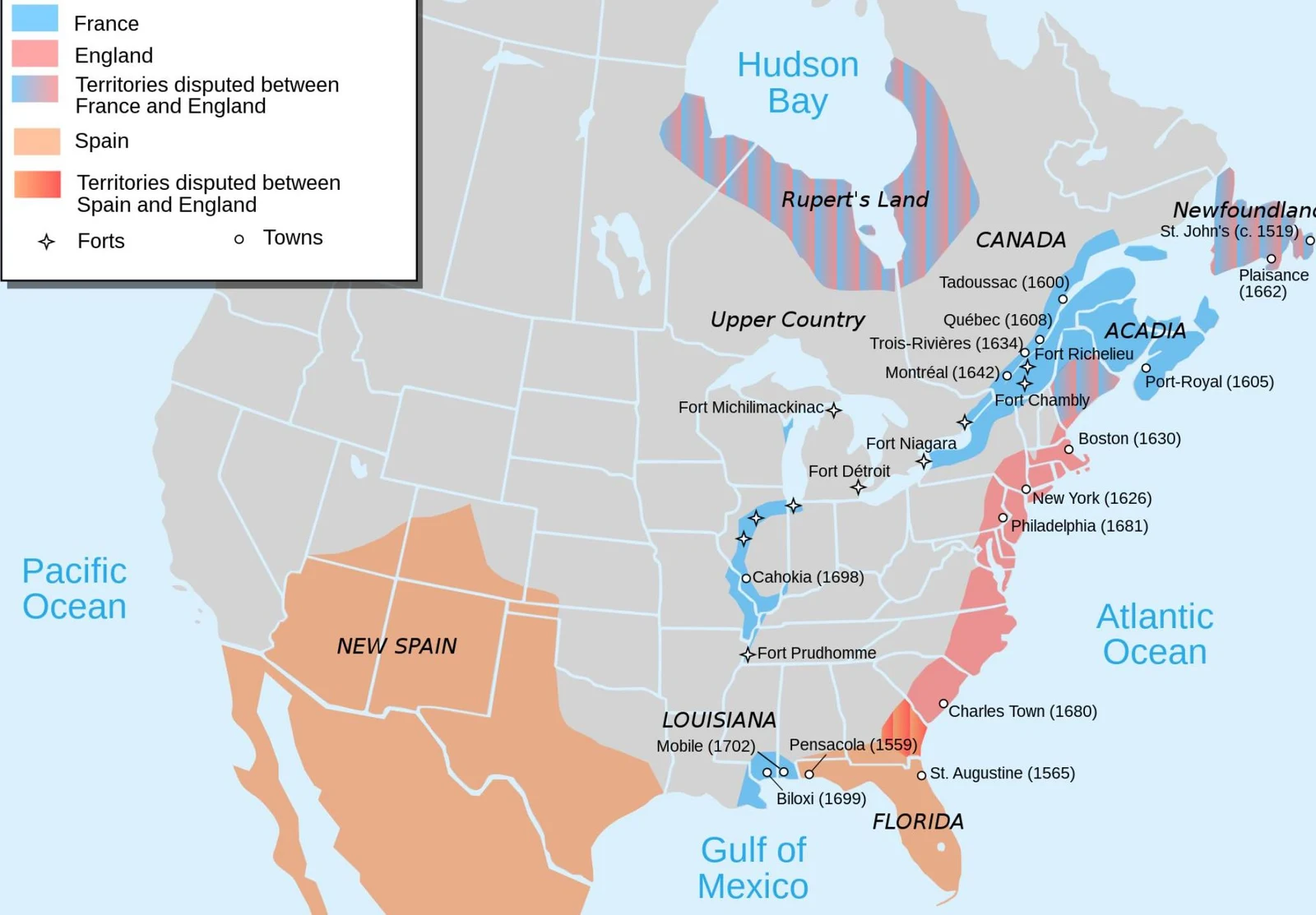
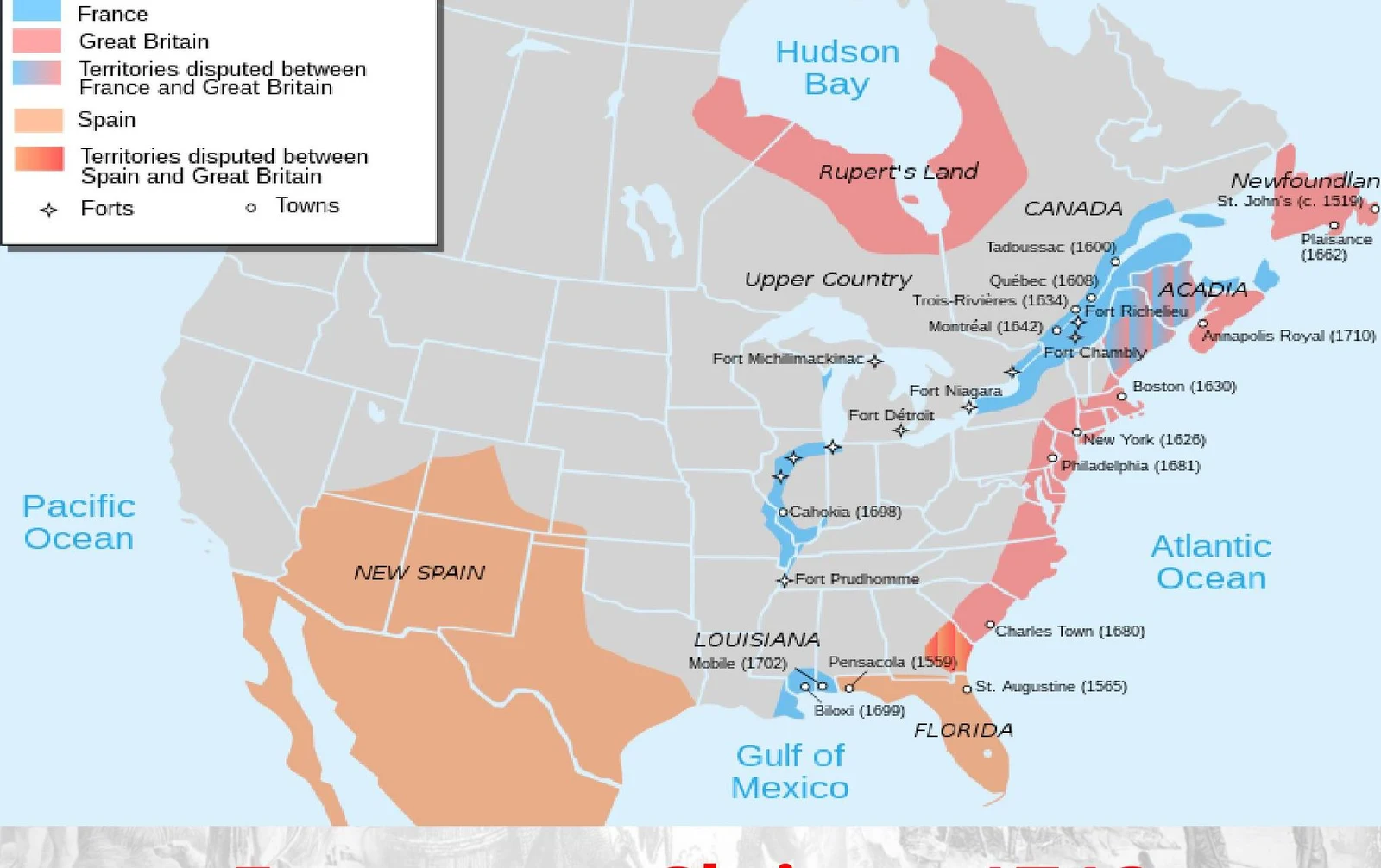
The geography of these territories was often defined by strategic military installations and trade hubs. Cities and forts were not just settlements; they were tools of empire used to secure borders and control economic flows.
Keep reading for free.
Create an account to finish this reading and make it part of your study routine.
Continue reading freeAlready have an account? Log in
Updated